



Andropilot

คำอธิบายของAndropilot
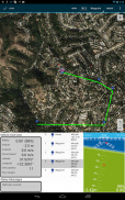
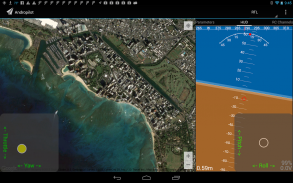
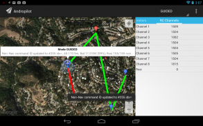
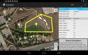
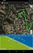
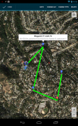
This is a hobbyist UAV control program. It will control your Ardupilot based UAV and display vehicle position on a map. You must have a 3D Robotics telemetry module attached to your android device through a USB-host mode cable.
If this seems like gibberish you probably don't want this application. ;-)
For more information see our discussion group: http://www.diydrones.com/group/andropilot-users-group
If you like this app, please give us a good rating on the Play Store. If you find a bug in this volunteer written application, please report it here: https://github.com/geeksville/arduleader/issues. Using our bug-tracker gives us a better way to respond than just anonymous play store comments.
This application is released under the GNU Public License v3. Copyright 2012 Kevin Hester.
Full license and other information on github: https://github.com/geeksville/arduleader/wiki
</div> <div jsname="WJz9Hc" style="display:none">นี้เป็นงานอดิเรกโปรแกรมควบคุม UAV มันจะควบคุม Ardupilot based คุณ UAV และตำแหน่งยานพาหนะแสดงบนแผนที่ คุณต้องมี 3D โมดูล telemetry หุ่นยนต์ที่ติดอยู่กับอุปกรณ์ Android ของคุณผ่านทางสายโหมด USB เป็นเจ้าภาพ
ถ้านี้ดูเหมือนว่าพูดพล่อยๆที่คุณอาจไม่ต้องการโปรแกรมนี้ ;-)
สำหรับข้อมูลเพิ่มเติมโปรดดูที่กลุ่มสนทนาของเรา: http://www.diydrones.com/group/andropilot-users-group
หากคุณต้องการ app นี้โปรดให้เราดีคะแนนเกี่ยวกับ Store เล่น หากคุณพบข้อผิดพลาดในโปรแกรมนี้เขียนอาสาสมัครกรุณาแจ้งได้ที่นี่: https://github.com/geeksville/arduleader/issues ที่ใช้ Bug ติดตามของเราจะช่วยให้เราเป็นวิธีที่ดีที่จะตอบสนองความเห็นที่ไม่ระบุชื่อกว่าเพียงการเล่นเก็บ
โปรแกรมนี้ถูกปล่อยภายใต้ v3 GNU ใบอนุญาตสาธารณะ ลิขสิทธิ์เฮสเตอร์ 2012 เควิน
ใบอนุญาตเต็มรูปแบบและข้อมูลอื่น ๆ ที่ github: https://github.com/geeksville/arduleader/wiki</div> <div class="show-more-end">


